BUSES
The likely time, not the printed one
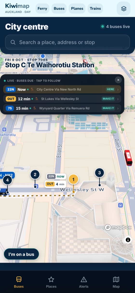
Kiwimap learns from the live feed how each route actually runs, then shows when your bus will most likely get to your stop, plus your walk.
See where your bus really is and when it will most likely reach your stop. Ferries on the harbour, planes overhead, and the city in 3D. Free on iPhone.

The Android app isn't out yet. The live map works in Chrome in the meantime.
WHAT'S IN THE APP
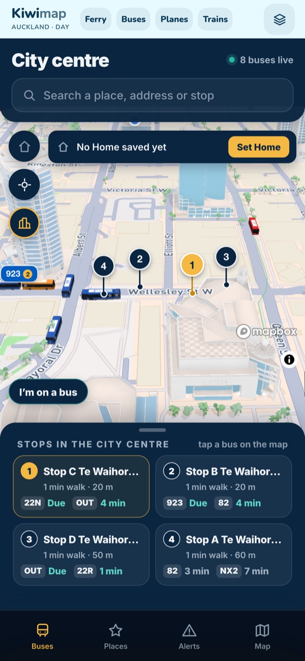
Everything moves on the map from live data: live transport feeds and live aircraft feeds. The 3D city is built from public LiDAR, so the buildings are where they really are.
Kiwimap learns from the live feed how each route actually runs, then shows when your bus will most likely get to your stop, plus your walk.
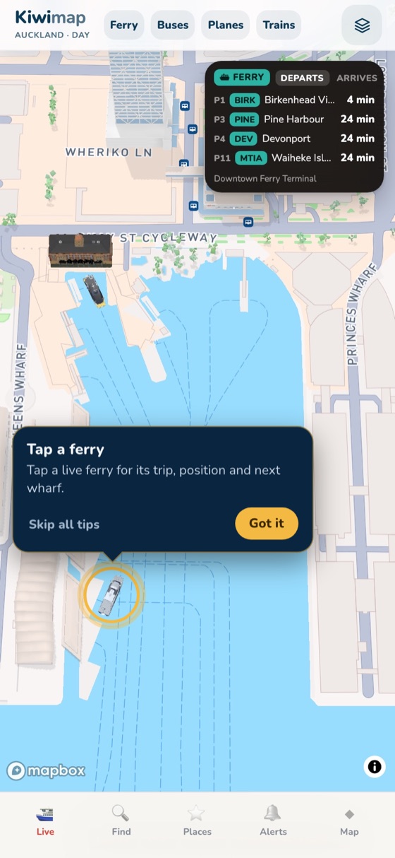
Departures from Downtown, and each boat on the water with where it's heading and when it gets in.
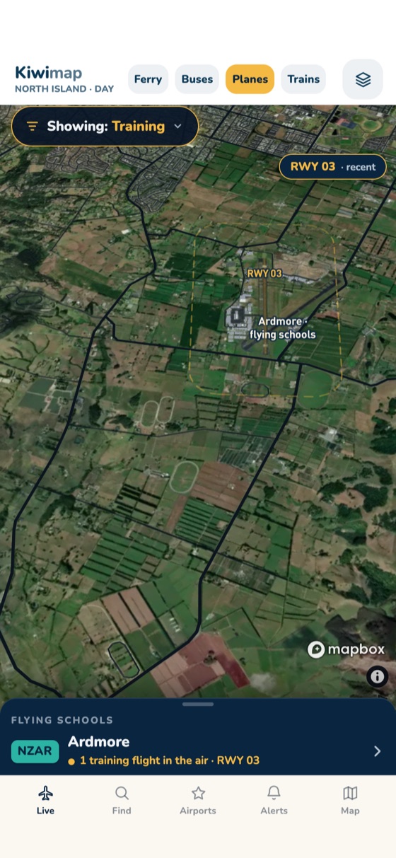
Airliners into Auckland Airport, helicopters, and the training flights circling Ardmore. Tap one to see what it is.
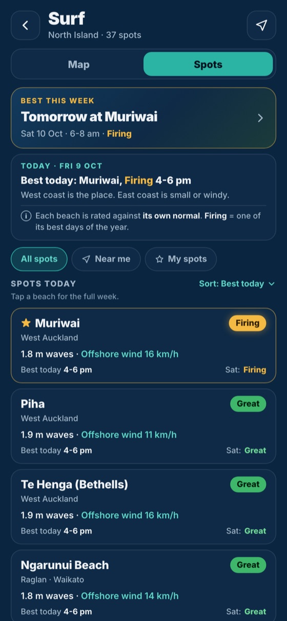
141 beaches on both islands, each rated on one scale from the swell, its period and the wind. Now in the app.
WHO MADE THIS
I flew as a commercial pilot for three years and I'm CEO of a hotel chain in Cyprus. I've also run event companies across Europe, and these days I build with applied AI.
Kiwimap is a one-person project. I designed it and built it end to end with AI coding agents: I scope each job, check what comes back, test it on the street on my own phone, and I run the whole thing.
Flying is why the planes and ferries had to move the way they really do. Years in hotels are why every screen starts with what the person at the bus stop needs, and AI is how one person ships all of it.
Tools I use every day, including Claude Code, ChatGPT and Codex, Gemini, DeepSeek, Kimi, Cursor, and open-weight models run locally with Ollama.
QUESTIONS
Yes. Kiwimap is free on the App Store.
Not yet. On Android, open the live map in Chrome at kiwimap.com/live.
Live transport data for buses and ferries, live aircraft position feeds, LINZ maps and LiDAR for the 3D city. The surf forecast uses marine forecast data. Full credits are on the credits page.
Auckland for buses and ferries. Planes cover the North Island, and surf forecasts cover 141 beaches around New Zealand. Other cities are coming.